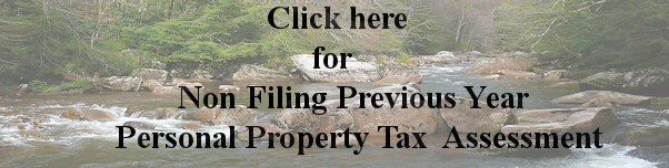
Welcome to
Search

Modules
· Home
· Downloads
· Journal
· Private Messages
· Recommend Us
· Search
· Statistics
· Stories Archive
· Submit News
· Surveys
· Top 10
· Topics
· Web Links
· Your Account

Who's Online
There are currently, 9 guest(s) and 0 member(s) that are online.

You are Anonymous user. You can register for free by clicking here

WV News
·Mountaineers Ringtones - Sponsored Link
·Western Kentucky horse cruelty case ends with plea
·Judge extends ban on early prisoner release
·Small-town Ky. mayor, son charged with vote buying
·W.Va.'s Rockefeller praises Obama's
·Rockefeller says Obama could win W
·W.Va. low-income kids get thousands
·West Nile threat looms again in W.V
·Police Investigating Thefts from Wo
·Mill Creek Woman Arrested in Robber

read more...

News
·Fishing Product Testers Wanted - Sponsored Link
·Sebelius: What 'Hillary Holdouts'?
·Stumper TV: Gov. Sebelius on Guantanamo
·Slideshow: The View from the Floor
·FINEMAN: 'A Master Craftsman'
·Level Up's Top Four Gaming Tidbits for August 28th, 2008
·Newsweek: How Biden would compare to Cheney
·Fineman: Clinton?s Masterful Speech
·Rebutting a Newsweek Story on Obama
·High-Tech House Hunt

read more...

  
Cabell County Geographic Information System Website


Click Here For Tax Maps & Data

Google Earth
Posted by JD on Thursday, September 15 @ Eastern Daylight Time (3543 reads)
Topic News or updates about the site
If you find our site and maps useful, accurate, practical or you just find yourself curious, facsinated, or even shocked at the technology. You haven't seen anything until you visit http://earth.google.com and see not just a glimpse, but the whole earth and the future of GIS.

While I could go on for days about it, I found an article that best describes it that you can read by clicking on the "read more" text below and I recommend you do.

It does take a moderately fast computer and you do need a broadband or fast internet connection to get the concorde like speed of flying from 5th Ave in Huntington to 5th Ave S in Myrtle Beach in 8 seconds.

Tips: Turn on streets and buildings then visit your favorite larger city. Try San Diego and see the Aircraft Carriers out in the bay. Enjoy.

Use this link for the direct download: http://earth.google.com/downloads.html


(Read More... | 7746 bytes more | Score: 5)

Official DFIRM's(Digital Flood Insurance Rate Maps) Online
Posted by JD on Wednesday, August 11 @ Eastern Daylight Time (3101 reads)
Topic News or updates about the site

IMPORTANT NEWS - - NEW MAPS

Cabell County and The Cabell County Assessor's Office entered into an agreement with FEMA as Cooperating Technical Partners a little over two and a half years ago to be one of the first few counties in WV to develop countywide DFIRM's (Digital Flood Insurance Rate Maps),.which enables modern, more accurate risk determination and regulation.

With over 20,000 communities in the National Flood Insurance Program (NFIP), it is a significant challenge to keep flood maps up to date. The Cooperating Technical Partners (CTP) Program is an innovative approach to creating partnerships between FEMA and participating NFIP communities, regional agencies, and State agencies that have the interest and capability to become more active participants in the FEMA Flood Hazard Mapping Program.

The DFIRM is comprised of all digital data required to create the hardcopy FIRM(Flood Insurance Rate Map). This includes base map information, graphics, text, shading, and other geographic and graphic data required to create the final hardcopy FIRM product to FEMA standards and specifications.
This product serves the purpose of map design and provides the database from which the Digital Line Graph (DLG) thematic product of the flood risks is extracted to create the DFIRM-DLG. DFIRMs are subjected to community review and approval and are, therefore, the official basis for implementing the regulations and requirements of the NFIP within the community.

These maps are currently available online by clicking the link below.
As a guide the following floodzones are labeled as followed:


A - An area inundated by 100-year flooding, for which no base flood elevations have been determined.
AE - An area inundated by 100-year flooding, for which base flood elevations have been determined.
X500 - An area inundated by 500-year flooding; an area inundated by 100-year flooding with average depths of less than 1 foot or with drainage areas less than 1 square mile; or an area protected by levees from 100-year flooding.
X - An area outside of a floodzone.
FW - Floodway areas in Zone AE.

Click here to view DFIRM's


(Read More... | 5577 bytes more | Score: 4.8)

2004 Cabell County Voting District maps online
Posted by JD on Wednesday, August 11 @ Eastern Daylight Time (2216 reads)
Topic News or updates about the site
In a cooperative effort with the Cabell County Clerk we are offering the ability to view the new Voter District maps.
You can now see these maps by clicking the links below.

Any questions pertaining to the District Maps should be directed to the Cabell County Clerk's Office.


(Read More... | Score: 4.33)

Cabell Parcel and Data Viewers
Posted by JD on Wednesday, August 11 @ Eastern Daylight Time (123014 reads)
Topic News or updates about the site
Currently there are three ways of viewing parcel data online.

1. The Simple Search Viewer - A search a map by name, address, or parcel ID
2. The HTML - A more advanced viewer with more navigation tools
3. The IAS - A more data driven webpage with that provides information from our Computer Aided Mass Appraisal system.


(Read More... | 2087 bytes more | Score: 3.66)

Username and Login
Posted by JD on Thursday, August 05 @ Eastern Daylight Time (4173 reads)
Topic News or updates about the site
Many of you in the past have created a username and joined the website in the past. With all the trouble we have had with the server, that is one of the few things that has been deleted. This should not cause any problem because all you have to do is sign up again.

This process is not mandatory to view or use any maps or data on the site, but helps in future customization of the website, important messages, possibly a discussion forum. and other features.


(Read More... | Score: 0)

  
Login
Nickname

Password

Don't have an account yet? You can create one. As a registered user you have some advantages like theme manager, comments configuration and post comments with your name.

Big Story of Today
There isn't a Biggest Story for Today, yet.

Old Articles
There isn't content right now for this block.

GIS News
·ESRI on Board to Offer Technical and Engineering Consulting Services through SeaPort-e
·U.S. Congressional District Geo-demographic, Voter Data Mapping Reveal American Political Landscape
·Intermap Technologies and Global Mapper Expand Partnership to Offer High-Res Digital Elevation Data
·GEOINT Full Symposium Price Increases on Sept. 1
·The 5-satellite RapidEye constellation is ready for launch from Baikonur on August 29, 2008
·SDS Provides Historical Preservation Solution to the Middle Rio Grande Conservancy District
·PSMA Australia purchases 1Spatial's Radius Studio
·Tom Clancy Game to Use Photo-Realistic Satellite Images to Portray Real World Backdrop
·Galdos Systems Inc. Awarded Web Servies Enablement Contract
·ESRI's New ArcGIS API for Flex Improves the Look and Feel of Web Mapping Applications

read more...

Web site engine code is Copyright © 2003 by PHP-Nuke. All Rights Reserved. PHP-Nuke is Free Software released under the GNU/GPL license.
Page Generation: 6.32 Seconds